UPDATE: The Chicago Tribune has posted side by side maps to allow you compare the old ward boundaries to the new ward boundaries.
If voters learn to use these kinds of resources and to call for them, instead of waiting for diligent news organizations to post them, the whole approach to redistricting in the future could be developed using technology and algorithms that would divide the city into wards based on population, common citizen interests, economic or commercial projects, and less on the raw interest of those who were elected to represent the public interest.
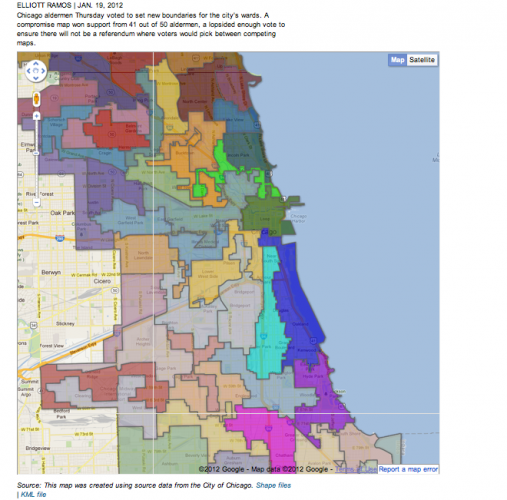
Redistricting of ward boundaries, triggered by the census, brings to mind Chicago’s stockyard origins and Upton Sinclair‘s descriptions of sausage making. It isn’t pretty, yet since our money and daily life is at stake, we have to pay attention. WBEZ‘s Sam Hudzik and Elliott Ramos covered the story from City Hall and produced a useful interactive map to help Chicagoans figure out what ward they will live when the map becomes law.
Whether you are going to find that your ward has disappeared or at least morphed from near the lake and loop to the Northwest side, or if your neighborhood will be cut in two by the new map, or spared, the story and map are a place to start figuring out the political geography that’s coming to town.









Be First to Comment